Landscape Science & Techniques (digital portfolio)
Introduction
Course code : ENVT1053
Course co-ordinator : TBC
Course weighting : 50% of 30 credits
This course element (digital portfolio) is in two parts. The first part is an introduction to AutoCAD and an exploration of 2D and 3D CAD techniques in general. The second part is specifically focussed on Digital Terrain Modelling (DTM), a very useful technique for landscape architects.
The use of drawing boards in Landscape Architectural practice died out towards the end of the 20th Century. These days, landscape studios are almost exclusively computer-based and drawings are almost exclusively digital. The tools of our trade include digital design software such as AutoCAD, Photoshop and SketchUp. This element of the Landscape Science & Techniques course is designed to introduce students to Computer Aided Design (CAD) and to provide the skills they will require in the modern, 21st Century landscape studio.

Typical landscape studio (2007)
Aims and Outcomes
- To introduce you to AutoCAD
- To begin your exploration of 2D and 3D CAD techniques
- To explore the use of contour data with CAD
- To introduce the concepts of Digital Terrain Modelling (DTM)
- To introduce analytical DTM software (Autodesk Revit)
- To use DTM software to analyse terrain models in various ways
- To use this software and other techniques to complete a "cut and fill" design exercise
Format
The element consists of twelve workshops each of three hours in length. All project work can be completed during the workshop sessions but extra time will be required for presentation. There are two assessed projects.
Course Schedule
The course schedule gives an overview of the timetable, weekly topics and submission dates for this course. There may be occasional changes, so check back frequently.
BA Landscape Architecture
| Date/Time | Studio | Title |
|---|---|---|
| 19th Jan 2016, 10am to 1pm | 11_1014 | Digital studio. |
| 26th Jan 2016, 10am to 1pm | 11_1014 | Digital studio. |
| 2nd Feb 2016, 10am to 1pm | 11_1014 | Digital studio. |
| 9th Feb 2016, 10am to 1pm | 11_1014 | Digital studio. |
| 16th Feb 2016, 10am to 1pm | 11_1014 | Digital studio. |
| 23rd Feb 2016, 10am to 1pm | 11_1014 | Digital studio. |
| 1st Mar 2016, 10am to 1pm | 11_1014 | Digital studio. |
| 8th Mar 2016, 10am to 1pm | 11_1014 | Digital studio. |
| 15th Mar 2016, 10am to 1pm | 11_1014 | Digital studio. |
| Spring Vacation | ||
| Self Study | ||
| 5th Apr 2016, 10am to 1pm | 11_1014 | Digital studio. |
| 12th Apr 2016, 10am to 1pm | 11_1014 | Digital studio. |
| 19th Apr 2016, 10am to 1pm | 11_1014 | Digital studio. |
This course element consists of twelve studio workshops each of three hours in length. Each workshop will take place in Studio 1014 on a Tuesday morning, starting at 10:00am and concluding at 1:00pm (see schedule for details).
Assessed Elements
This course includes 2 assessed elements. The weighting is as follows:
- Digital Portfolio: 50%
- Manual Portfolio: 50%
This class is for the Digital Portfolio only. The manual portfolio is organised and taught separately.
There are two assessed projects for this element of the course. The first project introduces you to Autocad software and there will be a task set at the end of each session to be completed by the following week. The second project will be taught after this. Details are given below and the project is designed to be completed within the workshop sessions so it is important that you attend all sessions in order to successfully complete the work. Although the assessment projects are design led, this is essentially a technical course and you will be assessed on technique and the accuracy of your results in addition to the normal design criteria.
Park Project Brief
Overview
Landscape architects are commonly required to produce site plans using CAD software. These plans will normally include various existing elements such as mapping, a site boundary and tree survey information, along with proposed features such as buildings, paths and planting. These plans will be produced to scale with appropriate text and title blocks, and maybe coloured to increase legibility. The site plan may also be visualised in 3D to gain a better understanding of the design; this may take the form of an aerial view or a perspective from eye-level.
The Brief
Your client is a local authority who wishes to revitalise an old cricket field and pavilion. They have converted an old cricket pavilion into a new park visitor centre which is to provide outdoor environmental education and a café. Your brief is to design a new outdoor classroom to include a pond for pond-dipping, a small tree copse and café terrace space. The wider park design is to include one football pitch, changing rooms and path network.
You are initially required to draw the existing elements of the park which will include the site boundary, buildings and car park. The measurements for these are set out in park-base.pdf. You will then create your own design within these parameters. Each week you will be set a drafting / drawing production task to gradually build up a set of CAD based graphics to explain your design. The process will take you through an understanding of CAD concepts and tools, layers, printing, scale and 3D presentation.
Submission Details
The project should be submitted as a multi-page .PDF file (on CD ROM). The file must be named using the following format: Student Userid-park-project.pdf. (please refer to the equivalent section in the quarry project brief for more guidance). The submission should show each weeks task completed to show an understanding of each stage of the CAD production process.
Quarry Project Brief
Overview
Landscape architects are commonly involved with the design of restoration schemes for large quarries. This exercise has two purposes, firstly it is a vehicle for learning a number of ground modelling techniques including cut and fill, and secondly it allows you to demonstrate your design skill in manipulating contours to create new landforms.
The Brief
Your client, LandWreck is currently negotiating with the relevant planning authorities for the development of a large quarry in an upland area of northern England. Anticipating that the scheme is likely to go to public inquiry, your client has asked you to develop a restoration scheme for the site. At this stage, you are asked only to come up with a landform design. You may be asked to do a detail design for the scheme if this first stage is successful. LandWreck have calculated that 25% of the volume of material extracted from the quarry will be overburden and spoil. This material will be available to create a sympathetic landform for the restoration scheme.
Materials
Your client has supplied you with one AutoCAD drawing (gm-base.dwg). This drawing contains three sets of contours, one for the existing landform, one for the proposed quarry and one that is common to both. Each of the three sets of contours is on two drawing layers, one for the 25m index contours and one for all the other 5m contours. In addition to the contour information, the drawing contains a number of spot heights on the floor of the quarry; these will be required to create a successful ground model of the quarry. The spot heights are defined as blocks. The block name is "LEVEL" and each block is inserted at its appropriate elevation (Z value). Drawing units are in metres. All project materials are available from the Documents section.
Submission
You are required to submit a presentation of your work in the form of a PDF file (on CD ROM). You may construct your presentation using PowerPoint or any other suitable software. The presentation should show the landform as existing, the excavated quarry and your designed restoration. Use perspective views, sections etc. as appropriate. Cut and fill calculations demonstrating that your design utilises 25% of the total extracted material must be included. You may use AutoCAD, Revit, 3ds Max, Photoshop and any other useful tool in the preparation of your submission. Your work must be completed and handed in on or before the date given in the Course Schedule.

Submission Details
This project should be submitted as a .PDF file (maximum file size 2MB). The file must be named using the following format: Student Userid-quarry-project.pdf. For example, if your userid is ab123, your file will be ab123-quarry-project.pdf. Do make sure that all images used are correctly compressed for screen resolution - this will help keep file sizes down. Please ensure that your name is clearly shown on all submitted work.
Course Documents
These documents contain all the information about the course, projects, briefs and tutorials. All documents are provided in PDF format. Some documents may also be provided in appropriate alternative formats. In order to view the PDF files, you will need the Adobe Reader.
There are currently 10 files in this section
| Filename | Size (KB) | Date Modified | |
|---|---|---|---|
| AutoCAD Revision Checklist 1 - Exercise.pdf | 43.6 | 27th Aug 2019 | |
| AutoCAD Revision Checklist 1.pdf | 17.4 | 27th Aug 2019 | |
| AutoCAD Revision Checklist 2.pdf | 15.8 | 27th Aug 2019 | |
| ENVT1053-Park-Deliverables.pdf | 57.0 | 27th Aug 2019 | |
| ENVT1053-Park-Photo.jpg | 3,575.4 | 27th Aug 2019 | |
| ENVT1053-Park-Site-2013-Dims.pdf | 107.8 | 27th Aug 2019 | |
| ENVT1053-Park-Site.pdf | 106.0 | 27th Aug 2019 | |
| ENVT1053-Quarry-Deliverables 2014.pdf | 55.7 | 27th Aug 2019 | |
| Selecting Digimap data for use with AutoCAD.pdf | 1,517.0 | 27th Aug 2019 | |
| Volume calculations with Revit 2014.pdf | 62.1 | 27th Aug 2019 |
Course Materials
Note: To download AutoCAD drawing files, right-click on the file link and select "Save Target As…"
There are currently 4 files in this section
| Filename | Size (KB) | Date Modified | |
|---|---|---|---|
| Contour Interpolation Worksheet.pdf | 111.3 | 27th Aug 2019 | |
| contours test.dwg | 29.1 | 27th Aug 2019 | |
| gm-base.dwg | 120.9 | 27th Aug 2019 | |
| sample_contours.dwg | 123.5 | 27th Aug 2019 |
Online Resources
- CADTutor - Tutorials, articles and resources for AutoCAD
- My CAD Site - Tutorials for AutoCAD
- Autodesk Student Community - AutoCAD software download
- Google SketchUp - Free 3D design software
Tutorials
Further Information
- Student Software - What to get and where to get it for free
- Autodesk Student Community - Signing up and downloading your software
- Digimap - Downloading and using Digimap data
- A guide to buying laptops & desktops - What you need and how to buy it
Key Texts
- Digital Drawing for Landscape Architecture by ¦ details
- Google SketchUp for Site Design by ¦ details
- AutoCAD 2013 and AutoCAD LT 2013 Essentials by ¦ details
- AutoCAD 2012 & AutoCAD LT 2012 Bible by ¦ details
- Adobe Photoshop CS6 for Photographers by ¦ details
- Photoshop CS6 Essential Skills by ¦ details
Digital Drawing for Landscape Architecture by Bradley Cantrel and Wes Michaels
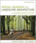
From the back cover: “For a hundred years, pencil, pen, markers, and watercolour have been the principal tools of representation for landscape architects and urban planners, Today, those hand-powered aids have been replaced by an array of digital tools. Digital Drawing for Landscape Architecture bridges the gap between the traditional analogue and the new digital tools and shows you how to apply timeless concepts of representation to enhance your design work in digital media.”
This book is unique in demonstrating the use of digital tools in combination to achieve high-quality results in the production of landscape drawings. Fortunately, it is also well-written by people with plenty of hands-on experience and it is beautifully illustrated in full-colour.
The book focuses primarily on Adobe Photoshop but also includes coverage of AutoCAD, Illustrator and 3DS as part of the workflow. It demonstrates a wide range of techniques (most of which are explained step-by-step) for various drawing types; design diagrams, plan/section renderings and perspectives. The book is great for beginners too, with an introductory section explaining the basic concepts such as the difference between vector and raster drawings.
Every student of landscape architecture should own a copy of this book.
Digital Drawing for Landscape Architecture is available at Amazon.co.uk
Preview Digital Drawing for Landscape Architecture at Google Books
Greenwich library: 8 copies ~ view catalogue entry
Google SketchUp for Site Design by Daniel Tal

This is a really excellent book, specifically designed for landscape architects. It demonstrates how SketchUp can be used to create 3D models of site designs by starting with the basics and slowly building towards more complex techniques. It’s also good on workflow too with a whole chapter dedicated to moving AutoCAD drawing data into SketchUp. Best of all, Google SketchUp is free, so students can build 3D models of their designs with just this book and a quick download.
The book is based upon a technique called “SketchUp Process Modeling”, which: “provides a step-by-step road map that will show you how to use the tools and functions to construct expressive models of exterior spaces and architecture. The process addresses three main areas of instruction: drafting, modeling order and organization. Mastering these skills will allow you to create models that are highly detailed and articulate, easy to work with, optimized for computer performance and organized.”
The book is really well produced with clear, full-colour illustrations. The tutorials are very good and quickly build a firm understanding of how SketchUp works. This book is highly recommended for all students of landscape architecture.
Google SketchUp for Site Design is available at Amazon.co.uk
Preview Google SketchUp for Site Design at Google Books
Greenwich library: 9 copies ~ view catalogue entry
AutoCAD 2013 and AutoCAD LT 2013 Essentials by Scott Onstott
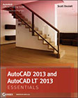
This is one of the best books for complete beginners to AutoCAD. It covers all you need to know to begin working with AutoCAD quickly and efficiently but it does so in a clear and straightforward manner. The book itself is less physically intimidating than most AutoCAD tomes at just under 400 pages but it doesn’t skimp on the essential details.
From the back cover: “You’ll learn how to draw in 2D, shape complex curves, manage objects with layers, organize with blocks and groups, add dimensions and annotation, work with layouts, plot and print, model in 3D, create realistic renderings, and much more.”
The tutorials in the book are well-paced, clear and illustrated in full-colour, giving it a friendly feel, which is great because AutoCAD can sometimes be a bit scary. Although not specifically written for landscape architects, students will find this book an excellent companion right through their course of study.
AutoCAD 2013 and AutoCAD LT 2013 Essentials is available at Amazon.co.uk
Preview AutoCAD 2013 and AutoCAD LT 2013 Essentials at Google Books
Greenwich library: 8 copies ~ view catalogue entry
AutoCAD 2012 & AutoCAD LT 2012 Bible by Ellen Finkelstein
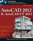
AutoCAD is a very popular professional software application and it is well supported by a large number or 3rd party manuals. In an ideal world, you should look at a variety of books and decide which is best for you. However, there is one book which is sufficiently generic and that most people seem to get on with that is worth a recommendation.
The AutoCAD 2012 & AutoCAD LT 2012 Bible by Ellen Finkelstein does two jobs. First, it teaches you how to use AutoCAD in the short term and second, it provides a reliable reference for you to keep over the longer term. The book begins with the basics of opening and saving drawings and moves on to an introduction of the basic 2D drawing commands and an explanation of the various interface components. At the other end of the spectrum, it covers customising menus and programming with AutoLISP and other advanced topics. In between these two poles there is coverage of 3D modelling and rendering, plotting, data extraction etc. At over 1200 pages, it's not a pocket book but it is a book that can be relied upon to answer most questions across a range of levels.
AutoCAD 2012 & AutoCAD LT 2012 Bible is available at Amazon.co.uk
Preview AutoCAD 2012 & AutoCAD LT 2012 Bible at Google Books
Greenwich library: 4 copies ~ view catalogue entry
Adobe Photoshop CS6 for Photographers by Martin Evening

The title of this book is now rather misleading because it seems to imply that this is a book for photographers only. Admittedly, the original concept for the book was to introduce photographers to the digital world of Photoshop and there is still a great deal for the digital photographer. However, over the years, the book has expanded and matured into what is now probably the best single-volume text book on Adobe Photoshop for both photographers and non-photographers. This book is not just about tweaking images to make them look better (although that is included), it covers a wide range of Photoshop skills. In fact, one of the best chapters in the book, “Layers, Selections and Masking”, takes the reader beyond the confines of traditional photography and into Photomontage. The accompanying DVD includes project images from the book and video tutorials. As a comprehensive introduction to Photoshop, Martin Evening's book is hard to fault but if you prefer a more technique-based book, take a look at the “Essential Skills” book by Mark Galer and Philip Andrews.
Adobe Photoshop CS6 for Photographers is available at Amazon.co.uk
Preview Adobe Photoshop CS6 for Photographers at Google Books
Greenwich library: 3 copies ~ view catalogue entry
Photoshop CS6 Essential Skills by Mark Galer and Philip Andrews
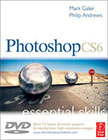
This is a relatively new book, first published in 2007 and has been written specifically for Photoshop CS3. This third edition for CS5 builds on the previous editions. It is a very good book with a great introduction to the application and to digital imaging in general, particularly useful if you're completely new to digital design. For example, it covers the effects of image compression and a discussion on image resolution – both topics that students need to understand. It is also copiously illustrated in full colour with excellent examples. It is clear, concise and easy to follow - exactly what a good textbook should be. There is very good coverage of selections and layers (two key skill areas) as well as all the other “essential skills”. The book follows up with a series of projects that you can work through in order to practice the skills learned and it comes with a DVD containing all the example images and some really useful video tutorials.
Photoshop CS6 Essential Skills is available at Amazon.co.uk
Preview Photoshop CS6 Essential Skills at Google Books
Greenwich library: 6 copies ~ view catalogue entry
